
My brother Nigel had made a rare visit to Melbourne and with one day to spare, it was a toss-up between the Australian Open tennis and a back country walk. He’s much fitter than I am and in his younger years had been involved in long distance running through the outback, so no surprise we chose the back country option.
I had recently been exploring the Baw Baw plateau, walking from the Mt Baw Baw resort to St Gwinear and from the Mushroom rocks car park to Mushroom Rocks, but not up to Mt Erica or through to Mt Whitelaw.
Destination settled, we started the drive into Gippsland. Nigel recounted how had been using long drives for meditation worship sessions. So we plugged in the iPhone and cranked the tunes, at times singing and at times meditating on the words and the truth they hold for us. We prayed for one another and enjoyed each other’s company, living in different states made this time together a treat for both of us.
I’d walked to Mushroom rocks before, it’s a simple few kilometres through the Mountain Ashes on a tiny plateau dotted with granite boulders, tracks meandering off in all directions and flat grassy areas great for camping. It’s a (big) kids wonderland and great place to stop for lunch.

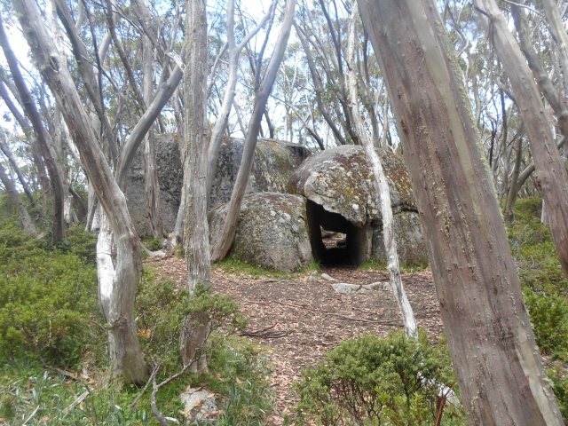
Mushrooms Rocks gets it name from the mushroom looking rocks that have formed in the Area. The Granodiorite plugs, as a result of volcanic action, are first exposed as the softer surrounding rock erodes away. Exposed, fault lines channel water charged with a mixture of acids, salts and bacteria that rot the rock, forming the base of the mushroom head. The longer this process continues the more distinct the mushroom shape becomes. The best example of the mushroom rocks is not immediately obvious from the main trail and you’ve got to do a little searching to find it. In contrast to the Mushroom Rocks is the caverns formed by other granite boulder collapsing into one another, the largest of these has room to sleep and make a fire.


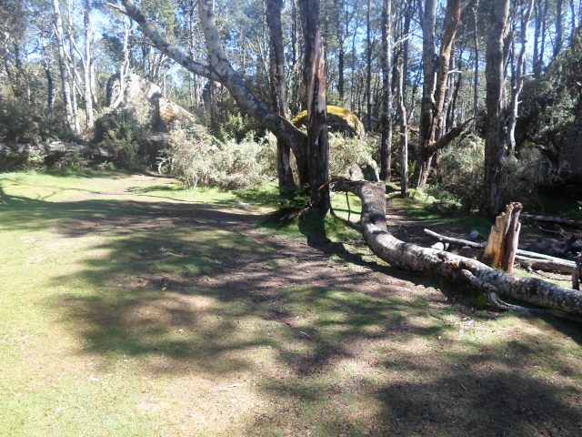
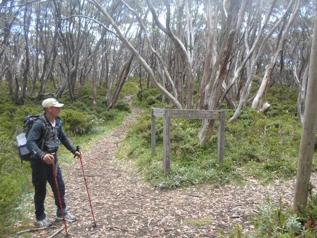
Mushrooms rocks is the last of the flat ground. It’s all up hill from here. The trail to mushrooms rocks started in thick moist forest with a few small crossings marked by granite boulders clothed in moss. It has a little elevation to it but nothing like the final ascent to Mt Erica.
The forest opened up and the ground drier, the Mountain Ashes dominate the lower slopes before transitioning to Snow Gums. There are a few switch backs as the trail leads toward the peak and it’s a short but strenuous walk to reach the top. Like many of the peaks on the Plateau, it’s still below the tree line and while there is a sign to let you know you’ve made it, there’s no rewarding views, the consolation is hut ruins to explore.
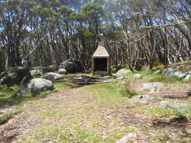
Talbot Hut sat proudly nestled in the snow gums close to a mountain stream and just off the peak of Mt Erica until 1939, when in the bush fires that year it was destroyed. All that remains is the stone fireplace, chimney crumbling as the years of harsh weather take their toll. The ground is flat and it’s a popular camping location. We take a quick breather check our maps and then continue toward our destination, Mt Whitelaw.

The vegetation has completely changed and at a little over 1500m, alpine heath dominates the landscape interspersed with snow gums, expertly adapted to live in this cold and at times snowy climate. We’ve felt the air cool slightly, but its high summer and clear skies, no chance of snow today, if anything this is fire country now.
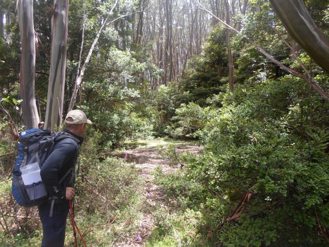
Leaving the hut ruins the trail narrows considerably and the heath is thick, whipping us as we pass through it. At times we are waist deep in it and I can see how it would be easy to lose kids up here if not yourself! The ground has flattened out and there are few landscape markers, we walk for what seems like miles, entering small clearings that have been used as camp sites and on more than one occasion get lost finding the exist. Many of the campsites have trails leading to small clearing and it’s a game to find the one trail that leads out.


Dispersed camping is permitted on the Baw Baw plateau, however being an alpine national park, fuel stoves are the only flame allowed, despite this there is evidence of many camp fires, just to irresistible on a cold crisp night.
Finally territory that is familiar, it’s the turn off to Mt St Gwinear. We’ve been walking on the Australian Alps walking Track, a 650 km trail from Walhalla in the south to Canberra in the north and we’ve lost a lot of time with detours and thick bush slowing the pace. Reassessing the goal, we decide to give Mt Whitelaw a miss, realising it’s still a good 15 – 20 kms (return) away, a new goal is set and that is Mt St Gwinear.
The junction is characterised by a little cave and flattened patches of earth one could pitch a tent. Given it’s the thoroughfare from Mt Baw Baw to Mt St Gwinear and on the Australian Alps Walking Trail it’s not the most private spot and I’ve passed it by previously in favor of mustering plains.
Last time I was here the weather was threatening and late that night everything was iced as the temp dropped below zero and the small ponds in the valley shivered to a freezing halt, crystallising on their surface, (Baw Baw, Too Cold for Comfort). Nothing could be further from that today as the temperature continues to rise and risk of sunburn increases.
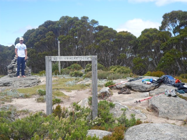
The trail leads into an open valley, dotted with little streams at it lowest point. I often think walking through here, that it would be a river if there ever was a flood. It’s followed by a little ridge that breaks the view into Mustering Flat’s before turning steeply in open terrain to the top of Mt St Gwinear.
I spot our old camp site and hear the brook babbling, hidden by the ground cover that protects its precious cargo eventually to be deposited into one of Melbourne’s largest reservoirs. The ascent to Mt St Gwinear is a goat trail mainly over granite slab, it’s a solid walk and poses no challenge to fitness or technical ability. Having said that, I have tried like many others to cross-country ski down it, and when you add snow and ice it is a whole other ball game. Let’s just say bum sliding was a new skiing technique I became intimately acquainted with that requires extreme flex at the knees while bumping ones bum along the slope keeping the ski’s perfectly downhill, clearly cross country is not for me!
At the top Nigel and I take an afternoon break, the vista is clear to the Alpine National Park, the sun reflecting off the Thomson Dam giving away it hiding places deep in the valley below. We pretty much have the place to ourselves and it’s a great opportunity to release our feet from the confines of their boot prisons and tune into the sights and sounds of nature, becoming one in the moment with our surroundings.

The sun’s showing signs of heading for the long summer twilight signaling time to retrace our steps and bid farewell to this special place so close to a major city but so far away at the same time.
Back in the thick bush we make our descent from Mt Erica. At Mushroom Rocks there is another opportunity to explore and a trail leading down the south face intrigues us. Pushing through the bush, it opens into a clearing, revealing a hut. This one is not for emergencies though and as we investigate further discover it’s a ski clubs hut, complete with 12 beds, a kitchen, lounge area and of course fire-place.


As we continue to the car park the wind begins to pick up and is distinctively warm, a northerly. I comment to Nigel that I wouldn’t camp up here this time of year the fire danger is just to high, especially when the northerly blows.

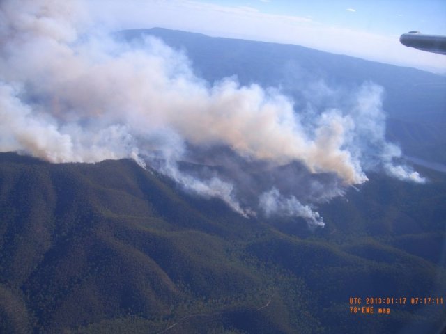
48 hours later a report in the news alerts us to the fact that a forest fire is well alight and out of control, posing a real risk to property and life near the township of Aberfeldy, just across the valley from where we were resting at Mt St Gwinear.
It burns for two weeks, thankfully not taking any lives and not crossing into the Baw Baw National Park

Pingback: Mt Baw Baw snow, look don’t touch | Hiking Faith