
Hiked April 7-8, 2012
During the summer of 2011/12 I was scoping out other potential short overnight hikes to keep building our confidence towards something more substantial in time to come. I came across the Baw Baw plateau which offers a range of routes from reasonably flat to fairly steep elevation, at least for Victoria.
The Baw Baw National Park is located on the boundaries between the Central Highlands and Gippsland regions of Victoria, Australia. The 13,530-hectare national park is approximately 120 kilometres east of Melbourne and forms the southern end of Victorian ski fields. Mt Baw Baw itself rises to an elevation of 1,567m and is the highest peak and most visited on the plateau. Other peaks include Mount Mueller (named after Ferdinand Von Mueller who was first to ascend the plateau, Mount Whitelaw, Mount St Phillack, Mount Tyers, Mount Kernot and Mount St Gwinear. The plateau itself is isolated from most of Victoria’s high country by the Thomson and Aberfeldy rivers and tributaries of the La Trobe River, including the Tanjil and Tyers rivers to the south.
In winter the resort operates a few downhill runs but the area is best known for its cross country skiing, the parks trails are marked by poles with all but the main trail poles being taken down in Summer.
The Mt Baw Baw ski resort offers excellent access to the park and once off the resorts property opens up to a north / south trail which forms part of the 650km Australian Alps Walking track, which stretches from Walhalla in the south to Canberra in the north.
I map a return route that will take us from the resort at Mt Baw Baw to the Mt St Gwinear car park, with a nights stop over at mustering flat ~18kms.

Following a winding steep journey up the western approach to the resort, the only sealed access, we arrive to a pleasant morning in April just weeks before Easter. The parking lot is relatively deserted with the last ski season well behind us and the next still a few months off.
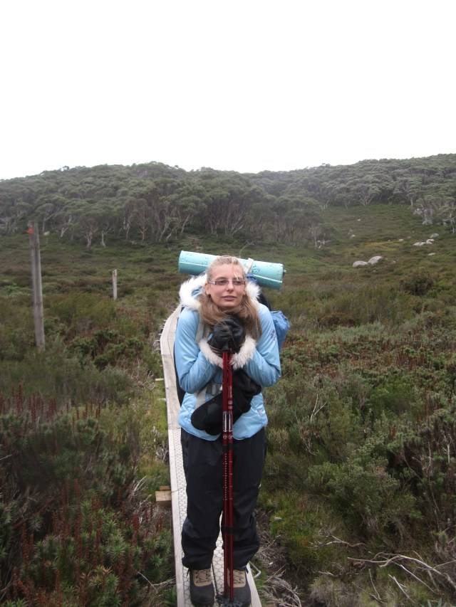
We’re packing the same gear we had for the Walk into History but with three improvements, a self-inflating mattress, pillow and winter rated sleeping bag.
The walk to the trail head is simple and follows the cross country ski tracks to the junction with Australian Alps walking track, Tanjil Bren is flowing and there seems to be good water supply so far. Turning right we disappear into thick snow gum forests, before emerging a little later at St Phillacks saddle.
The saddle is nicely grassed with views back to Mt Baw Baw one way and in the opposite direction the faint outline of Mt Buller. There are signs of camping and fire places, even though these are illegal within the parks boundaries. There is little vegetation on the saddle proper, the winds tears over this area for most of the year and if choosing to camp here you need to make sure you find a sheltered spot. We break for lunch and take in the views.
The track rises in elevation as it makes its way to Mt St Phillack, another of the peaks on the plateau. There is nothing to see, the top is a small mound of rock with no view for all the snow gums that grow there.

A well-defined track leads south and it’s not long before we’re at the turn off to Mt St Gwinear. The turn off is marked by small unstructured camp sites, some barely large enough to pitch a tent, but more impressively a rock formation that has created a sheltered little cave, a good refuge in the wet and possible overnight location in summer for the pure naturalists. The ground is boggy following last night’s rain, but the sky remains clear and we push on the last kilometer to mustering flats where we will make camp for the night. The trail narrows now we are off the main walking track that was marked by yellow triangles, but the landscape opens up into a wide low valley, dotted with granite boulders and well supplied creek. We watch our step lest we sink in the water logged alpine soil and drench our boots.


The trail crests a rocky outcrop and our destination is in site, we’ve not seen anyone all day, but we spy a tent pitched close to where we plan to make camp for the night. There is a young couple testing out their new Hilleberg tent, it’s impressive but out of my price range.
The couple share their stories of last night, cracking thunder and lightning that pierced the darkness and lit up the night sky, it sounds like quite a storm rolled through. Thankfully their tent kept them safe and dry and we pray that a repeat won’t happen tonight.
There is a little rise on the flat and everywhere we look is either wet, or squelches under foot. We find the only reasonably dry location and we make camp there, setting up the Mantis II for its second outing. A piece of wood, the remnant of a previous camper makes a great kitchen bench and with the chores done I lay back to take in the sounds and smells of the alpine region as the sun makes its way into the later afternoon.


My adventure bug bites and I’m keen to explore the narrow neck of the flat in the distance. To my disappointment it’s impassable without getting wet. I have my suspicions this open into another flat that skirts the base of Mt St Phillack and joins the saddle, but that will have to be an adventure for another day. I’m not sure we are even at Mustering Flats and start think maybe we are camping at Gwinear Flats, either way we are not moving.
The sun sets through a small ravine absorbed by the distant hills, the temperature noticeably drops making our evening meal of sausage and rice all the more enjoyable, I’ve got to get more creative in the outdoor kitchen.

The narrow neck we could see in the day starts to disperse mist like a smoke machine and within minutes we’re engulfed in a current of moisture passing in the low atmosphere, it’s relentless and coats everything, the clear moon now becomes eerily hidden with just a blur illuminated through the mist.


With everything coated the mist vanishes as quickly as it came and temperature plummets; time to enjoy the new winter sleeping bag, mattress and pillow.
I cannot get comfortable, I’m unable to find my younger self that could sleep on any surface. It’s cold in the tent, I can see my breath and since I’m a side sleeper either my face or back is pointing to the outside and getting uncomfortably cold.
In the middle of the night I’m woken by a chilling streak of cold, running down my spine, I’m shaking, teeth chattering. Taking a quick walk around the camp site to get the blood flowing, I see in the dim torch light that the moisture that settled earlier in the evening is frozen and the fly of the tent is covered in miniature icicles. I layer up with every bit of clothing I have and hunker down for a long cold, dark morning. I toss and turn unable to get warm, the winter sleeping bag seems to be doing nothing to insulate me, it’s a case of you get what you pay for (<$100) and I’m in for a teeth chattering body shaking ride over the next 5 hours.
The first rays of sun hit the tent, finally some warmth penetrating my frigid body, I snuggle in and enjoyed the thawing process. My daughter meanwhile had gone out exploring, I could hear her steps cracking the fine icicles that have coated everything overnight, even the shallow ponds now have a layer of ice over them.


The day is beautiful and clear, a nip in the wind and a thin layer of ice surrendering it’s grips to the ever growing warmth of the sun. Packing up is a challenge, everything things needs to be defrosted, fly pretty much stands up on its own.
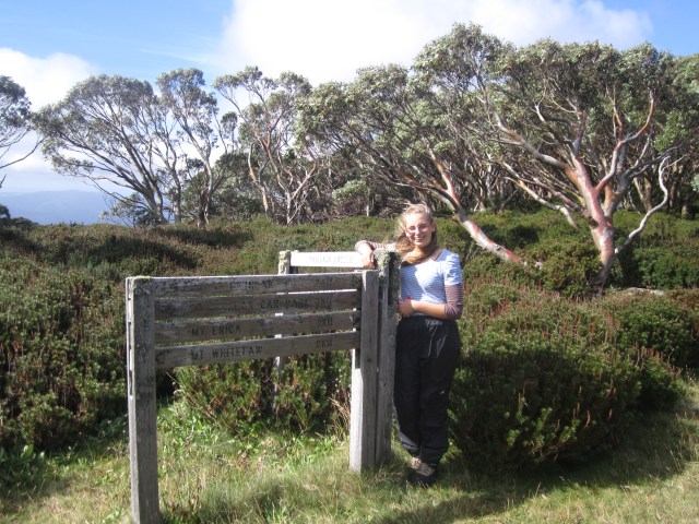
Leaving the flats we cross a little creek which was running strong and stop for a drink and refilling of water bottles before making our way back up to the trail, veering left and continuing through to Mt St Gwinear. The views from here are beautiful, you can see across the Thompson Dam to Aberfeldy and the continuation of the Victorian Alps. The top of St Gwinear is relatively wide and flat and offers a great place to relax, eat and take in the view.


We push on down the other side, I’m interested in the trail condition and facilities at the St Gwinear car park, this would make a good starting point for a snow camp avoiding the winter fees of parking at the resort.
The track is wide and easily drivable, not surprising given it doubles as the management track for Vic Parks and other authorities. There are a few minor creek crossing, not sure what supply would be like in Summer, clearly good in winter.
The car park has a map hut and sizable toilet and change block and during winter, Parks Victoria opens an office and hires toboggans. It’s free to access the park, what more could you want.
Following the trail back to the summit of St Gwinear, we pound back down the track, short but steep, making our way past the turnoff to Mustering flats (i think that is it) and retracing our steps uneventfully back to the resort.
Mt Baw Baw summit beckons us and we take a detour to soak in the scenery and indulge in my one of my daughters interests, photography.


The resorts Café is open and we start what will become a tradition of Hot Chocolate and Chips. Claire discovers she is the youngest to have camped overnight so late in the season.


All in all a great experience but we have some gear upgrades to make if we’re going to manage cold weather conditions better, I’m already thinking I’d like to experience a snow camp up here.
Park Information
Distance from Melbourne – ~120 km or 2 hrs, closet town is Noojee.
Park Type – National Park, fireplaces, pets and firearms are prohibited.
Camping – Dispersed bush camping is permitted on the Baw Baw Plateau. The Plateau is a fuel stove only area; therefore no solid fuel fires are permitted. The area falls within domestic water supply catchments, so care must be taken with the disposal of human waste. Try and camp in already made sites to protect the fragile alpine environment from further damage. There are no facilities other than at the St Gwinear carpark and the Baw Baw resort.
Water source – There is no potable water however water can be found in Tanjil Bren between the resort perimeter and the Junction with the Australian Alps Walking Track. Further water sources are between the Junction of the Australian Alps walking track and the trail to the summit of St Gwinear and on Mustering Flat itself. Additional water maybe sourced close to the St Gwinear car park. No water source is guaranteed year round. While we were there (April) water was available from all the above sources other than near the St Gwinear carpark, recommend you bring enough water for your stay and if you do need to drink the river water boil it or in some other way treat it first.
Attractions – Landscape views, summits, exploring, peace and quiet
Reference – Parks Victoria – Baw Baw National Park

Pingback: Eastern Tyers Creek,where to sleep? | Hiking Faith
Pingback: Mt Baw Baw snow, look don’t touch | Hiking Faith