
Rising early, rubbing my eyes as I peer out the window the morning looks like rubbish and I think our plans to walk from the Thomson River bridge to Eastern Tyers creek might be thwarted by the weather. Given our previous experiences with the cold up on the Baw Baw Plateau (Baw Baw, Too Cold for Comfort) I’m not keen to hike anywhere it’s going to be wet. I’m also really desperate to get out of civilisation and breathe in the forest air and get amongst the great outdoors and wide open spaces.
I convince myself the weather will be better at the trail head and if not we’ll still make a day of it, a reconnaissance trip or something. The route takes us out to Moe on the Princes Highway and then up through the hills to Rawson and onto the river. We discover a shortcut through Erica and over a bit of dirt road that the Astra handles well cutting 15 minutes off our 180 km journey from Melbourne.
The bridge is upstream from where we camped at Coopers Creek as a family, Coopers Creek, don’t forget the sauce. There’s reasonable parking, stay out of the gated area though. This bridge represents the end or the beginning of the steam train ride to Walhalla, so the gated parking area is only open when the train is running, and this is no metro line!
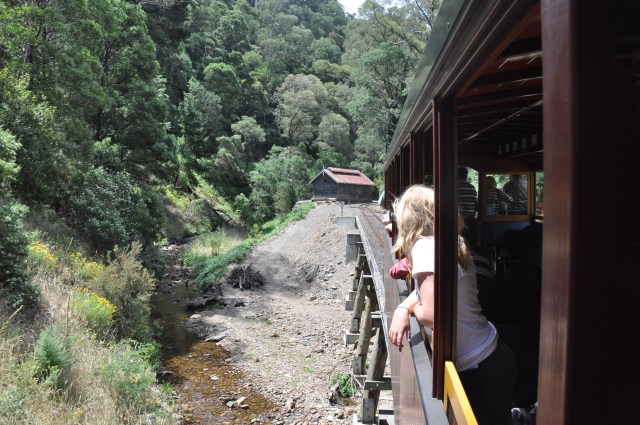
A remnant of the Moe to Walhalla railway, opened in 1904, the line went into decline as Walhalla retreated from being the premiere gold mining town with the closure of the Long Tunnel Extended Goldmine in 1911. The line finally fell silent in 1956, after a long period of ever diminishing services and stops. After many attempts to reopen it, it was made a tourist attraction in 1994 and renamed the Walhalla Goldfields Railway.
The scenic tour takes in the forest, creeks and ravines between Walhalla and the Thomson River Bridge and is a favourite with tourist and locals alike. It brings back to life the mighty era of steam and the imagination of the hub and bub of the bustling gold fields.

The journey is touch and go, the rain seems to be coming in squalls, the bridge is wet and the weather is lingering, difficult to make a decision one way or the other. Our trip plan will take us from the Thomson River Bridge to Poverty Point following the old tram line used to transport wood to the gold mines of Walhalla. Crossing the Poverty Point bridge the route follows the river traversing high above it along a rocky ledge before veering left and climbing Fingerboard Spur. The trail crosses the Thomson Valley road then winds through the forest that make up the lower slopes of the southern end of Baw Baw to Eastern Tyers creek.
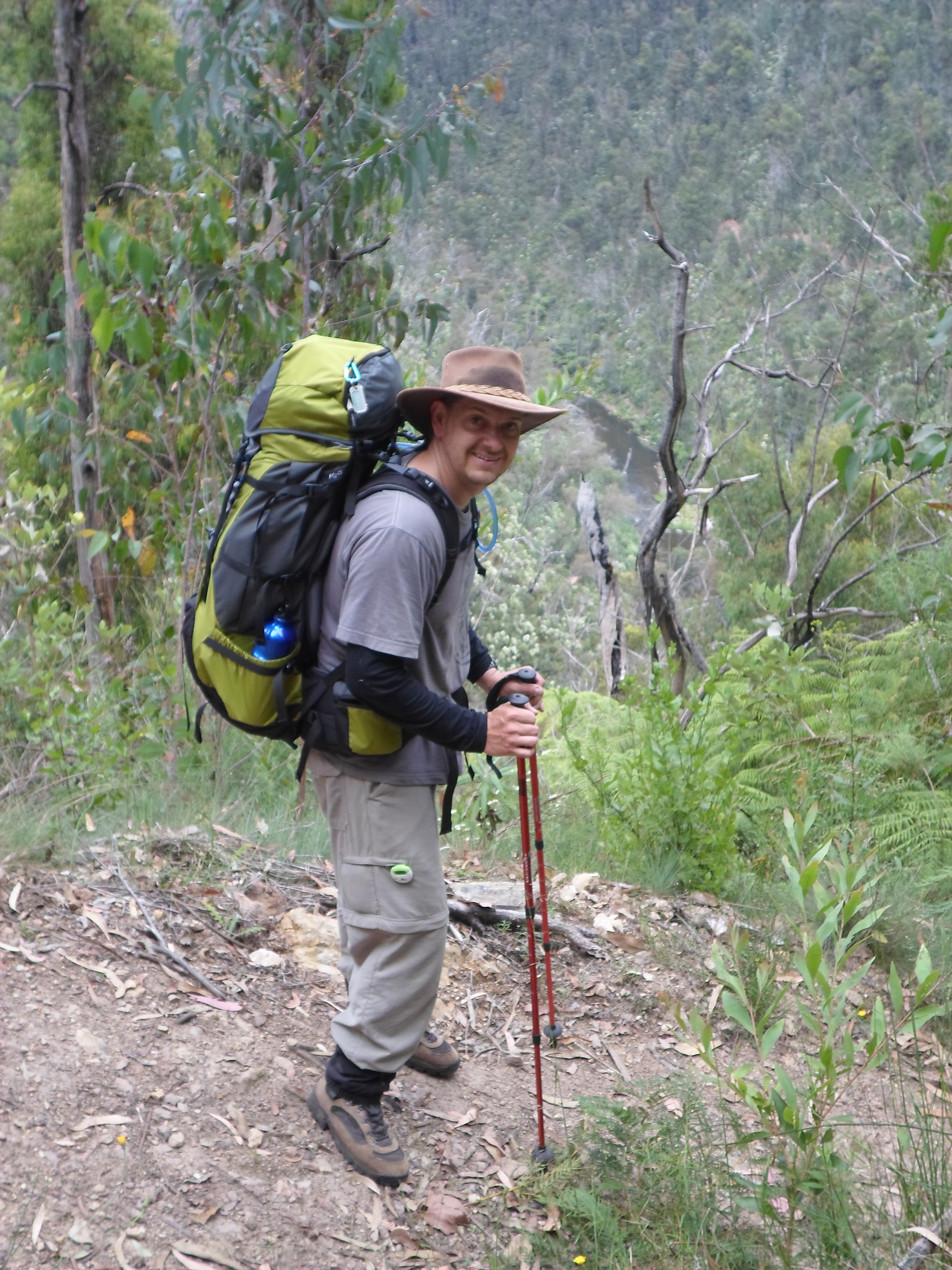
We agree to take our gear and walk to the poverty point bridge and see what the weather is doing there before we commit to the rest of the journey. The walk starts with an immediate thigh burner, the Mormon Town track. Thankfully two thirds of the way up we meet the intersection with the tram line and take the chance for a rest. Dripping sweat, the weather doesn’t seem to matter anymore.

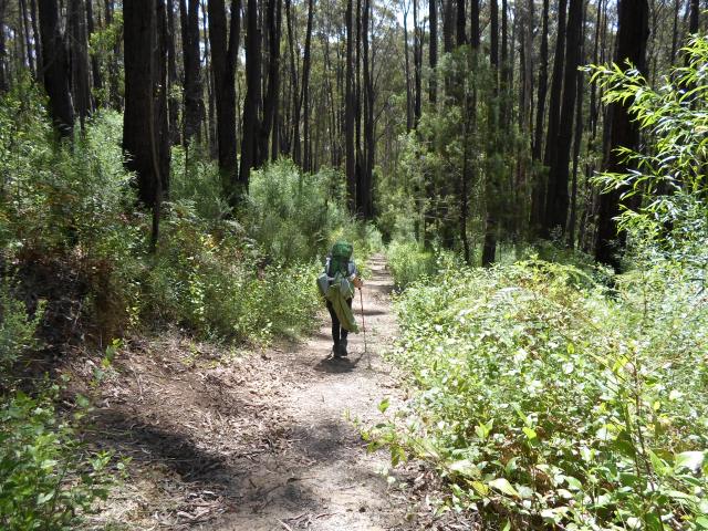
The track is clear and uneventful and it’s a great time to chat with Claire as we mindlessly put one foot in front of the other. There are a few little creeks that are running, and there is no concerns about water on this trip.
The river comes into view from high above and I have a flash back to a walk we did at the Capellano Bridge in Vancouver, Canada. It was just after Salmon season, some had beached on the rocks, what a tasty meal and no bears. No such luck here, maybe a few small Bass or Perch but that would be about it.

The river comes in and out of our view as the tram line follows it course. I pause and look down, it’s a bend in the river that has created quite a sand bank and nice deep looking water hole just downstream. Note to self this could be a fun overnight river camp for a future adventure.

There is nothing of the Poverty Point settlement to suggest it was ever here, other than a sign that shares the history of the area. Italian and Swiss families made the area home, remaining close to the timber they logged for the mining companies. Houses were typically bark huts with clay floors. Most families had a cow or goat and grew their own vegetables. On weekends they’d walk into Walhalla to buy other provisions, such as flour and kerosene. Any remnant of it is long gone and we continue on our way along the tram line to the Poverty Point Bridge.
The river starts to narrow and the banks gets steeper as we approach the bridge, now an all steel construction, but it wasn’t always that way. Originally constructed from timber it joined the Walhalla and Erica sides of the valley together. It opened the Erica side for logging meeting the insatiable need for timber for the gold mines boilers. It was re-decked in 1974 with all the materials being brought in by helicopter.
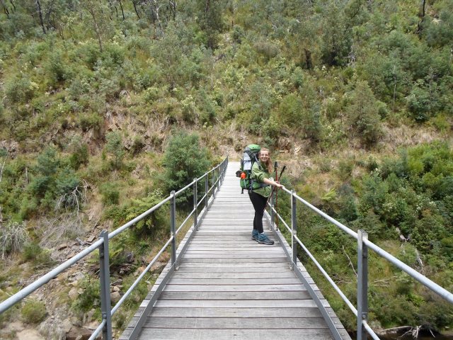

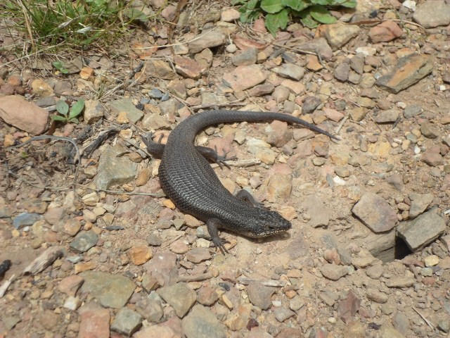
For someone who doesn’t like heights it feels a long way up, but it’s solid and there is no sweaty palms. Like a troll at the bridge we encounter a Black Rock Skink. He’s busy sunning himself and doesn’t appreciate the intrusion flattening himself out to look larger to his threat (us). He’s not moving either and after a look we skirt around him.
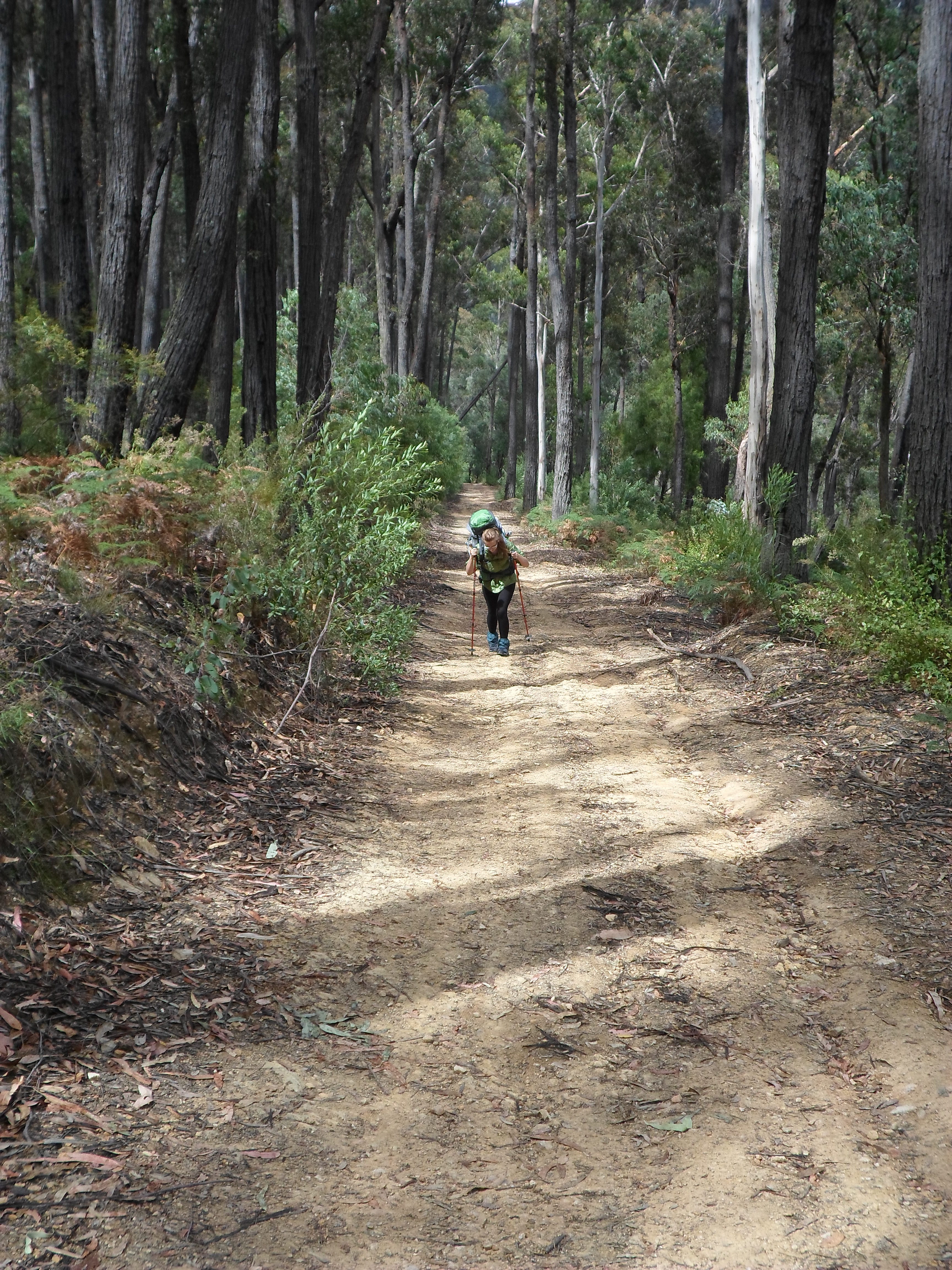
The track we have been walking on is the southern end of the 650km Australian Alps Walking Track, which stretches from Walhalla to Canberra. I’m expecting that it will be pretty well trodden and easy going. Crossing the bridge the track narrows and climbs steeply, high above the river in what now looks more like a gorge. The edge is exposed and sure footing is needed to crest it.

The track is surprisingly overgrown, with trees down in places and in others the grasses and small bushes reclaiming it. The walk has quickly gone from leisurely to obstacle course. The scenery is beautiful with the steep walls of the gorge giving way to friendly slopes.


We veer left and start the incline up Fingerboard Spur, which is steeper than it looks and it didn’t take look for us to break out in a sweat. Clearly our fitness is not what it should be and we walk a bit and break, walk a bit and break. The breaks becoming longer than the walks! A tail slithers into the grass and without seeing the head I’d rather believe I saw a lizard than a snake. It’s a reminder to beware of snakes especially in Summer. The weather has cleared and with the sun out the ground begins to steam.

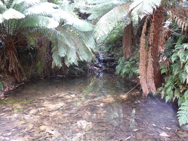
Safely across the Thomson Valley road, the scrubby bush gives way to a more moist environment with a thicker cover of forest, Mountain Ash in particular. The descent from the road to the creek winds its way down a small hill offering great views through the forest, there is something special about being in this environment.
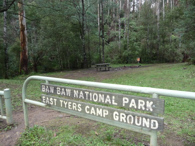
The faint sound of water becomes audible as we reach the bottom of the hill and start moving across the lower landscape, rising to a torrent as we crest the last little hill into the camp ground.
Eastern Tyers is considered walk in only, however there is a dirt track accessible to two wheels drives. Thankfully while we are here no else arrives and we have the site to ourselves. There has been signs of a caravan, so clearly people in the know do drive in and camp.
There are appears to be three main sites to pitch the tent, one down near the river, it’s a private little spot and close to the water, but I’m concerned about the bugs and the space is small. The second is more exposed, has a table and fireplace, but is big enough other campers could join you which is not my preference. This must be starting to sound like Goldilocks and the three Bears… The third one is just out of the main campground and best suited to a caravan, but worked well for us, it’s a flat raised area with a little bush behind and at the end a waterhole with a small waterfall, noisy but if you back up a little, OK.

We pitch up, enjoy a swim and a clear evening, no bugs to speak of this time. Dog tired we turn in for the evening, lulled off to the dolcid tones of the waterfall. Actually not all that dolcid, in the quiet of night it felt like I was sleeping under it and it was more like a roar, just as well I packed ear plugs.


Morning came before we knew it and this time we had the right mix of equipment for a good night’s sleep. I start the morning with a quick dip in the waterhole. If I wasn’t awake before, I am now. The creek is fed from the Baw Baw plateau and is freezing.


All refreshed and packed up we meet a dad with his children taking on the southern slope of the Baw Baw plateau, he tells us of a place called Mushroom Rocks that they are walking to. Mental note to self I’ve got see this place, rocks in the shapes of mushrooms!
I look up the trail on the other side of the creek it’s steep. Unprepared and with no map, it’s a fleeting thought to tackle it, but decide it is an adventure for another time.

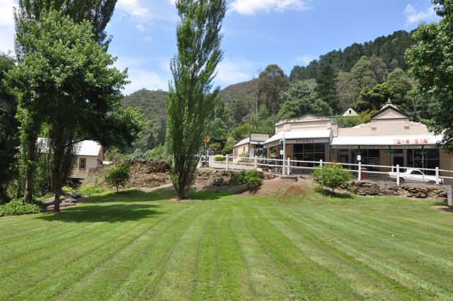
We retrace our steps back to the car, downhill seems so much easier. As has become our custom we choose to drive through to Walhalla and savour a hot chocolate and chips in the quaint little town that bustles in the summer months
Buoyed with new hike ideas, I’m already thinking what our next adventure should be.
Park Information
Distance from Melbourne – 180km or 2.5 hrs, closest town is Erica.
Park Type – State Forest.
Camping – There is camping at Eastern Tyers Creek for drive and walk in visitors. The camp site has a pit toilet, table and fireplace
Water source – The creek appears to run year round (running strong in December). Water can be collected on the Thomson River enroute. Any water collected should always be properly treated
Attractions – River, Fishing, Animal sighting, birds, peace and quiet
Reference – Parks Victoria – Eastern Tyers Creek
