
Popularised by the 2007 movie of the same name the “Bucket List” has come to represent all the things we dream of doing before kicking the bucket (die), Wilsons Prom is definitely one of those experiences.
Lately I’ve been restless about staying in Australia or at least Melbourne and that’s got me thinking about all those bucket list things right on your back door step that you take for granted and wholly expect them to be there forever.
Last year I got to tick off an amazing bucket list experience, The Great Wall of China” which I’ll write about this Winter in my ever-growing backlog of posts. This year I wanted to experience another and it was one that has been sitting in the back of my mind for a year or two, the southern circuit at Wilsons Promontory.
Wilson’s Promontory or the Prom as it is affectionately know is so popular that to stay at the main camping and holiday ground, Tidal River, you need to enter a ballot the summer before the summer that you want to holiday. Equally in demand are camping spots in the Prom’s many walk in locations.
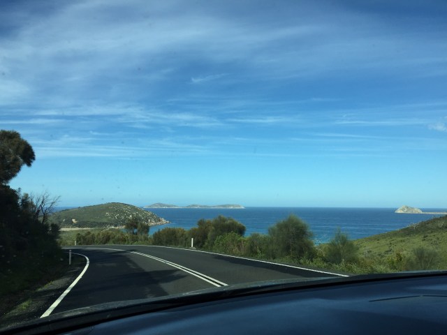
The area is a wild peninsula, a land accentuated by steep moutain ranges, large lowland plains and vegetation that reaches to the ocean. It juts out into Bass Strait forming the southern most point of the Australian mainland and is located within the Gippsland area of Victoria, 200km, or about 3 hours drive on sealed roads from Melbourne.
Indigenous occupation by the Gunai and Boonerwrung clans dates back 6,500 years. First Europe contact occured in 1798 by George Bass, who along with Matthew Flinders named the prom after Thomas Wilson in honour of Flinders friend. In more recent history the prom has seen, whailing, sealing and military activities. Its sometimes bloody past has been hidden by the many spectacular enevironments, most of the prom is now National Park.
A portion of the was first declared a National Park in 1898. It contains the largest coastal wilderness environment in Victoria at 50,460ha. The prom is the oldest existing park in Victoria, being fully and permanently reserved in 1905. It has become an international destination must do for the adventurous, over 380,000 visitors enjoy the park every year.
We had a failure to launch on this adventure late last year and then earlier this year I was looking down the barrel of the colder weather sweeping in and closing out the opportunity until Spring.
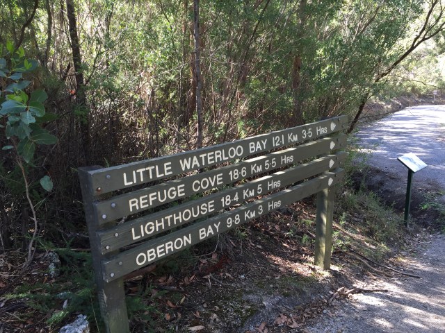
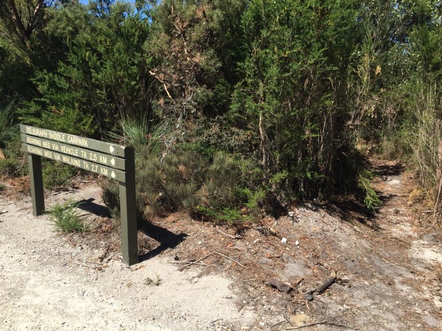
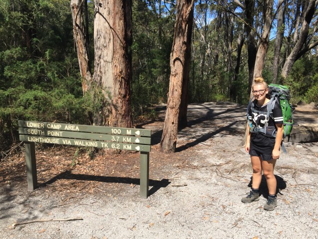
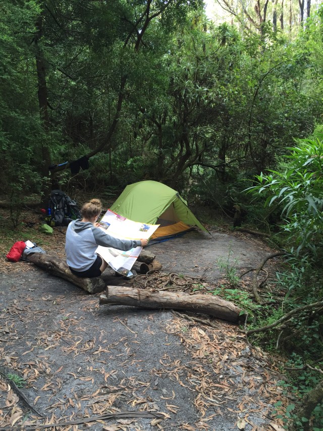
Watching the weather and collaborating with Claire on her calendar, we were confident we saw an opening for early March. I set about planning and booking and while I shouldn’t have been, was surprised at how quickly some of the sites booked up. Sealers Cove was gone before I knew it, the most popular and accessible of the walk in sites, so plans need to be amended and we settled on a 4 day walk, starting at the Telegraph Car Park, taking in Roaring Meg, South Point, Wilsons Prom Lighthouse, Little Waterloo Bay, Refuge Cove and Sealers Cove.
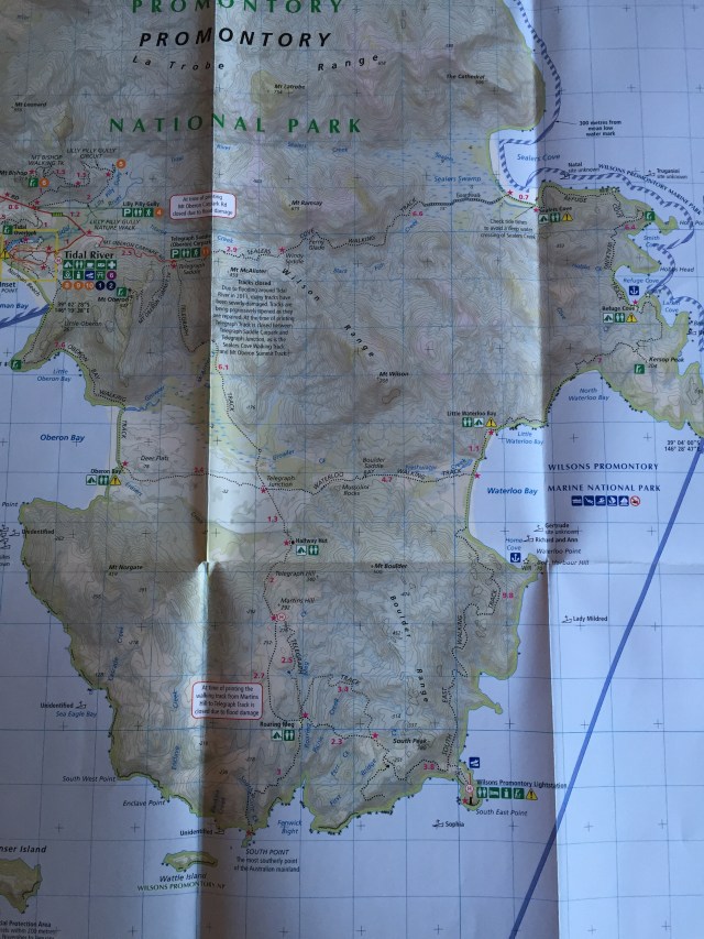
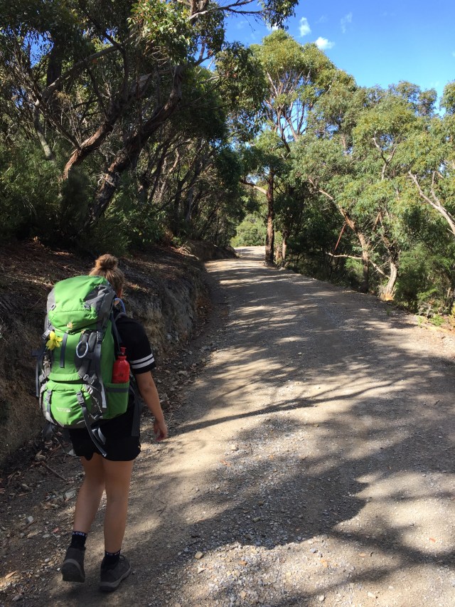
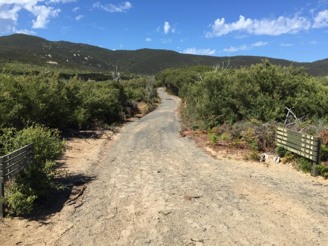
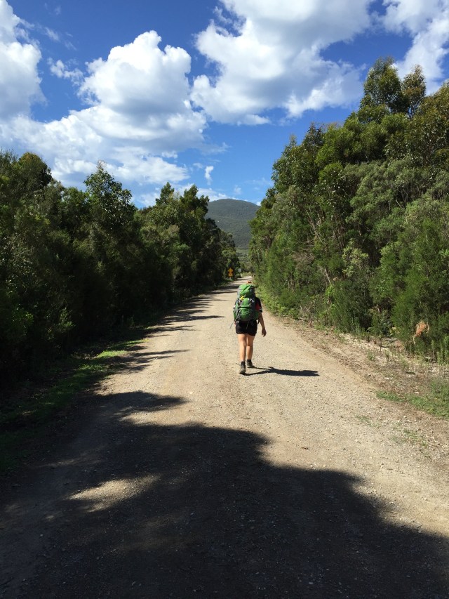
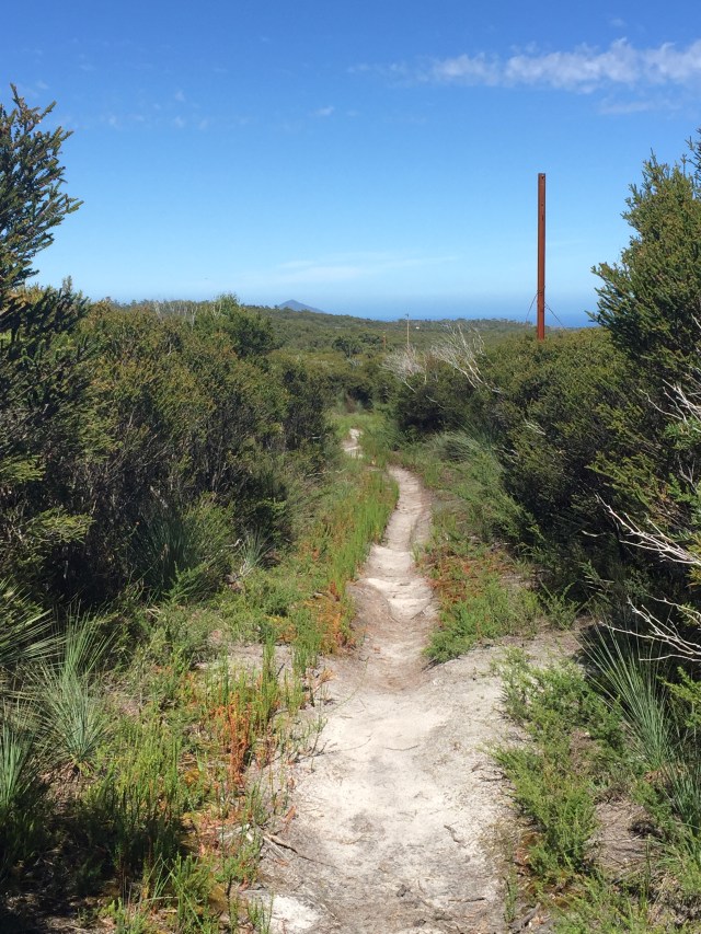
We got away from the car park under sunny skies walking the Telegraph Track, which was once used to maintain the single wire telegraph that connected the lighthouse to the outside world through Morse Code. Now a parks management track it’s still used by the ranger to drive within 4kms of the lighthouse before walking the remainder of the journey.
Travelling across creeks and marsh lands, Dipplodicus rasie their heads curious of the strange two legged creatures, wild triceratops fight for placement in the open field and suddenly everything freezes as the roar of the Tyranosaurusrex thunders it’s dominion throughout the land. Must have had heat stroke!
Crossing the valley is the junction road a quicker way to get to Little Waterloo Bay or Oberon Bay or a shortcut home if the southern most end takes too much out of you. We’re determined to do this and keep on course for Roaring Meg creek our overnight stop.
We’ve been advised the prom has good water flowing at all camp locations and so we’ve taken the risk to carry enough water for a day but not the entire trip.
Mt Wilson looms ever larger in front of us and it’s impossible to see where the track goes as we face what looks like an impenetrable wall of mountain peaks and ranges. Claire comments on how big the mountain is and I’m reminded in Matthew, Jesus talking to his Disciples says “The simple truth is that if you had a mere kernel of faith, a poppy seed, say, you would tell this mountain , “move”! and it would move. There is nothing you would be able to tackle”. I haven’t seen a mountain move but I have seen faith heal me, you can read about it in my post “I need a miracle, that’s what I need”.
Soon we are at half hut and as its name suggest its half between the Telegraph Saddle and the lighthouse. The creek is dry here and has been for some time, the hut is still in good condition and adjacent is a quaint campsite, not somewhere I would plan to stay though, no water and no views doesn’t make for a very exciting location.


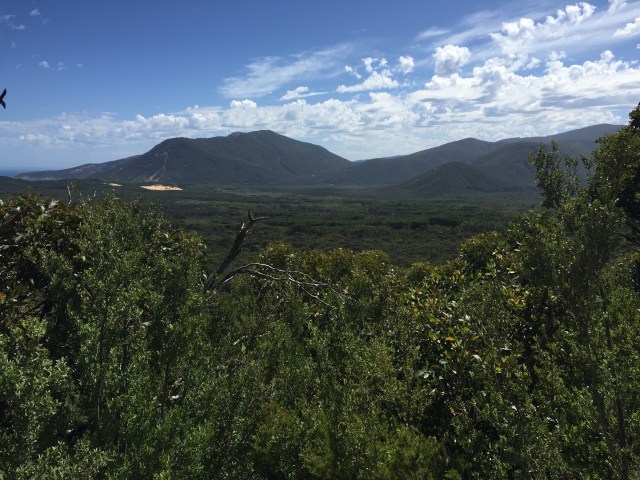
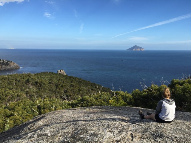
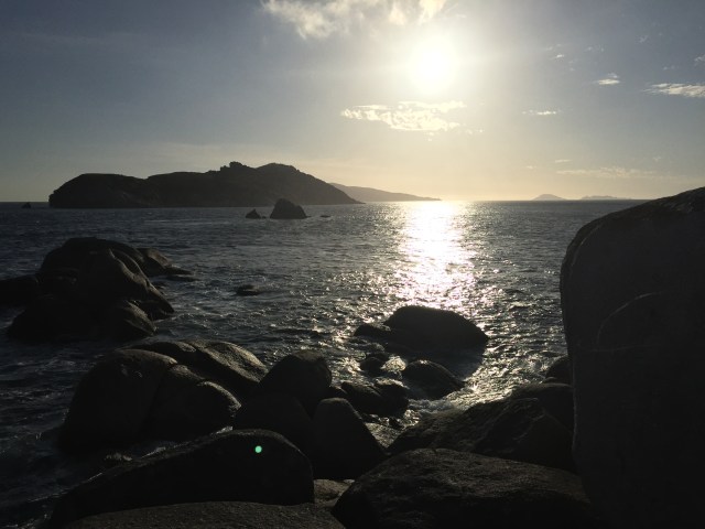
Immediately after, the valley starts to rise as it meets the range that billows up into Mt Wilson. The track snakes to the right following it contour’s lifting us ever higher above the valley floor and looking even more now like a scene from Jurassic park. We stop in and breath the majesty and expanse of this place, sand dunes in Oberon Bay glistening like gold in the midday sun. The climb to the top is never ending. Just around this corner I keep telling myself and then there it is, a small cut in the inpenetrable forest with a sign pointing the way. Within a few minutes we are in coastal heathland the vast plains of the valley behind, we make our first sighting of Bass Straight. The Straight stretches from the Victorian coastline down to the northern coast of Tasmania, and is as unpredicatiable as it is unforgiving. Something many sailors competing in the Sydney to Hobart have experienced firsthand.
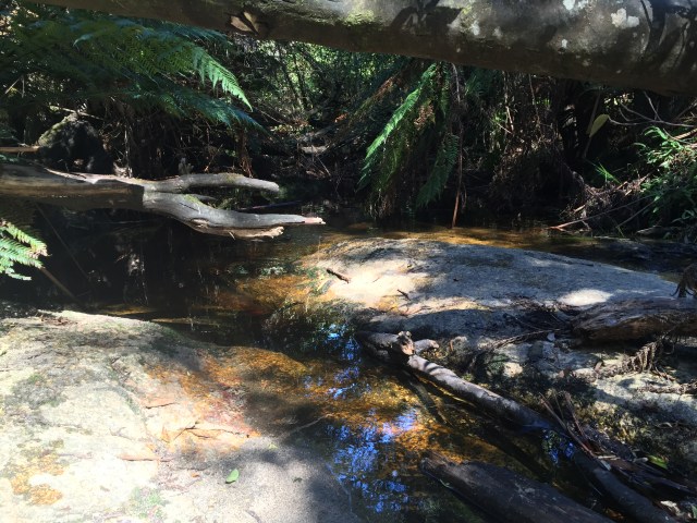
Roaring Meg isn’t exactly roaring and I think it more aptly named Whispering Meg. The water is beautiful and refreshing and as I pour it over my head and face the remnants trickling down my back, my body goes into goose bumps. This is too good to splash over me, finding a deep hole I take the plung, washing off the hours of dust, dirt and suncream of the days walk. The sun’s rays glisten as the water ripples across the pond, slowly being drawn into the narrows where is forms small falls over the slabs of granite that characterise the area.
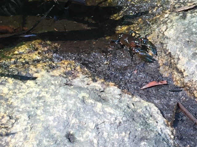
Sitting on the rock contemplating life fish come out of the shadows swimming freely in the lit water, rustling leaves in the shallows give away a yabbies position and he blindly goes about his scavenging oblivious to the towering mass sitting on the rock right above. Suddenly he relaise the danger lurking above and with a flick of his tails jettsions backward into the leaf litter. I remain in a conplative state wondering whether he will reappear. He does and this time ventures out of the water and within centimeters of where I am sitting, what a short memory! Oblivious he moves within my comfort zone his claws out leading the way. He’s too close for my comfort and I spring up scaring him out of his shell. He hits the panic button madly flicking his tail but seemingly forgetting his not in the water anymore. I can smell his fear as his legs push his girth in reverse every firbe of his being now focus like a laser on surviving. Finally in the safety of the litter, I make my way to back to camp, rock hopping the granite slabs that tessellate the creeks flows contorting it right to left and left to right, at times bubbling over the surface and in other instances underneath, welling up like a little spring from deep in the ground.
The landscape is characterised by ridges and deep gouged valleys, meaning that a lot of walking is detouring around these significant formations in order to connect with the next ridge. Interestingly most valleys have been carved and continue to be so by creeks that in flood scour the walls of their weathered granite deposits, causing deep impassable gullies the lower you go. We soon learn valleys means walking up and ridges mean walking down, counterintuitive at first but when you think about it, makes sense.
I’ve been on the lookout for snakes all day, the temperature had been in the mid 20’s and the warmed granite tracks and flat rocks looked like an ideal place for our cold blooded friends but alas none were seen. Until out of the corner of my eye one of the trees roots stretching out across the path, began to slither, stopping in my tracks the root morphed into a snake making its way into the scrub on the other side. It seems unperturned by us which was good, although it was small (30cm) I’m pretty confident it was a tiger snake
Wilsons Prom is no stranger to snakes and Tiger snakes are just once of it’s residents. These snakes can be particularly agressive, are venomous, in the kill you category and accurate strikers. If you see one give them a wide birth. Stomping the ground in environments know to be inhabited by snakes is a good way to make sure you don’t see them. Snake feel the vibration in the ground in the same way we hear.
Shy creatures, you’ll generally get bitten if you get too close, attempt to touch them, or accidentally step on them. A bit like what you could expect if you did these sames things to a strange in the street…
If you do get bitten, stay calm and move as little as possible and send someone to get help if practical. Do not wash the area of the bite or try to suck out the venom! It is extremely important to retain traces of venom for use with venom identification kits.
The lymphatic system is responsible for systemic spread of most venoms. This can be reduced by the application of a firm bandage (as firm as you would put on a sprained ankle)
Apply a pressure bandage over the bite area extending toward the central parts of the body. Immobilise the bandaged area with a splint and esnure the person doesn’t move. Be aware you may need to manage for shock and keep your fellow hiker as comfortable as possible in the elements
You can a great snake bite first aid card, here
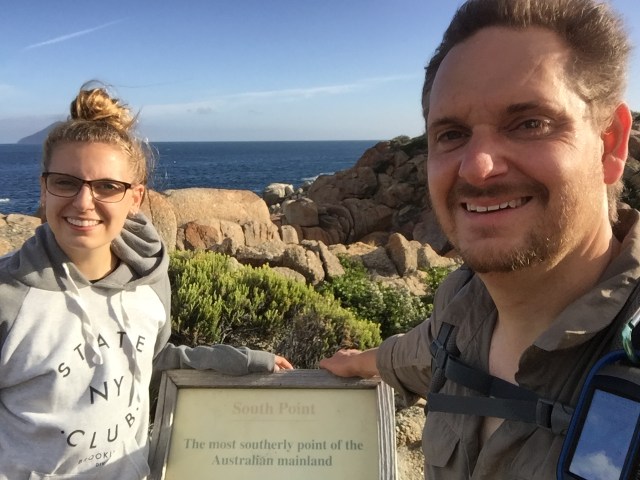
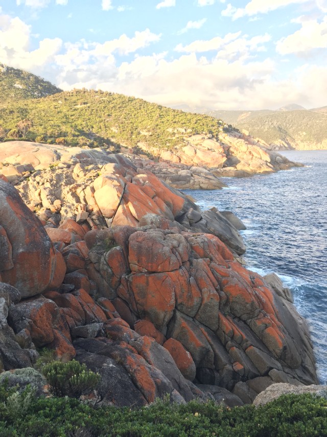
South Point while geographically significant as a destination was initially disappointing. An old whether sign a good 100+ meteres from the actual end of the land mass hearlds you arrival, but the view of the actual end of the land mass is obscured by a vegetated hill. After the build up in my mind it seemed an anticlimax.
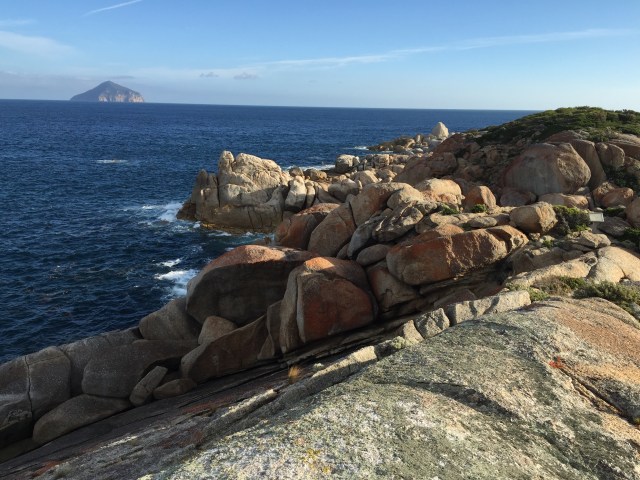
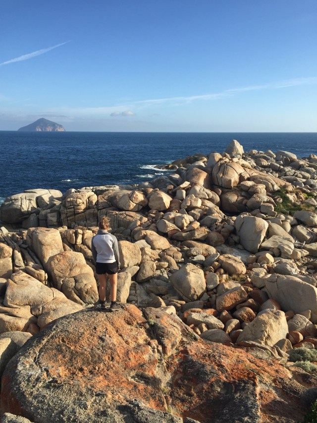
Our eyes are captured by the red rocks lining the coast, a secne that is quintesentially Wilsons Prom.
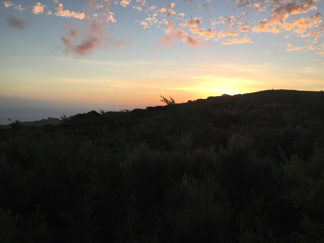
As we prepared for bed, the night was clear, the moon still sleeping on the other side of the planet and the sky was black with only the twinkle of stars. Down at the creek taking a final rinse for the day I couldn’t see my hand in front of my face, I only recall one other experience of blackness like this.
My wife and I were just newly married living in northwest Queensland. Invited to cave at Camooweal we jumped at the opportunity. Deep in the bowels of the cave on a ledge that lead to a sheer drop to the water table our guide told us to turn off our headlamps. The darkness was so dark, so black. Our eyes were struggling to adjust and make out a landmark, it was physically disconcerting, I felt that again deep in this valley.
The camp site is silent and we are left alone in our own companionship with just the trickle of the creek to lul us off to sleep.
Hiked March 3, 2016
Park Information
Distance from Melbourne – 200km or 3 hrs, closest town is Yanakie.
Park Type – National Park, fireplaces, pets and firearms are prohibited.
Camping – There are numerous camp sites within Wilsons Prom, these need to be booked through Parks Victoria. The sites in the southern circuit all have composting pit toilets and a selection of small and large sites. The park is a fuel stove only area; therefore no solid fuel fires are permitted.
Water source – There are water sources at all the southern circuits camp sites, however at the time of posting these sources have dried up at Halfway Hut and Oberon Bay. Check witht the local rangers office in regard to the sites you plan to stay at. If you plan to drink the water it will need to be appropriately treated.
Attractions – Ocena views, rock hopping , exploring, birds, peace and quiet
Reference – Parks Victoria – Wilsons Promontory
Reference – Parks Victoria – Southern Prom overnight hikes

Pingback: Day 3 – Wilsons Prom, Refuge Cove or was that Party Cove | Hiking Faith
Pingback: Day 4 – Wilsons Prom, mountains to sea | Hiking Faith
Hi there, just became aware of your blog through Google, and found that it’s really informative.
I am going to watch out for brussels. I’ll appreciate if you continue this in future.
A lot of people will be benefited from your writing.
Cheers!
Thanks I appreciate your encouragement, hope you enjoy the last post on our adventures on the Cross Cut Saw in the Alpine National Park